
How to Plan Your Mountain Adventures

What better way to spend your time at home than getting down to some serious adventure planning?
We’ve put together the ultimate guide on how to explore the world, plan adventures and create routes, all from the comfort of your sofa.
Gathering Inspiration
Browsing the map can be a great way to discover new locations and find inspiration. To help, our collections of adventures we call Guidebooks are the perfect place to start. Our guidebook themes include location, activity and difficulty level amongst others.
Some guidebooks are curated by us and some by our network of guides, athletes and outdoor brands. In each guidebook you’ll see the Author under the summary.
To check out our Guidebooks, head over to the website or open up the app and begin the search for your inspirational Guidebooks by name, destination or activity.

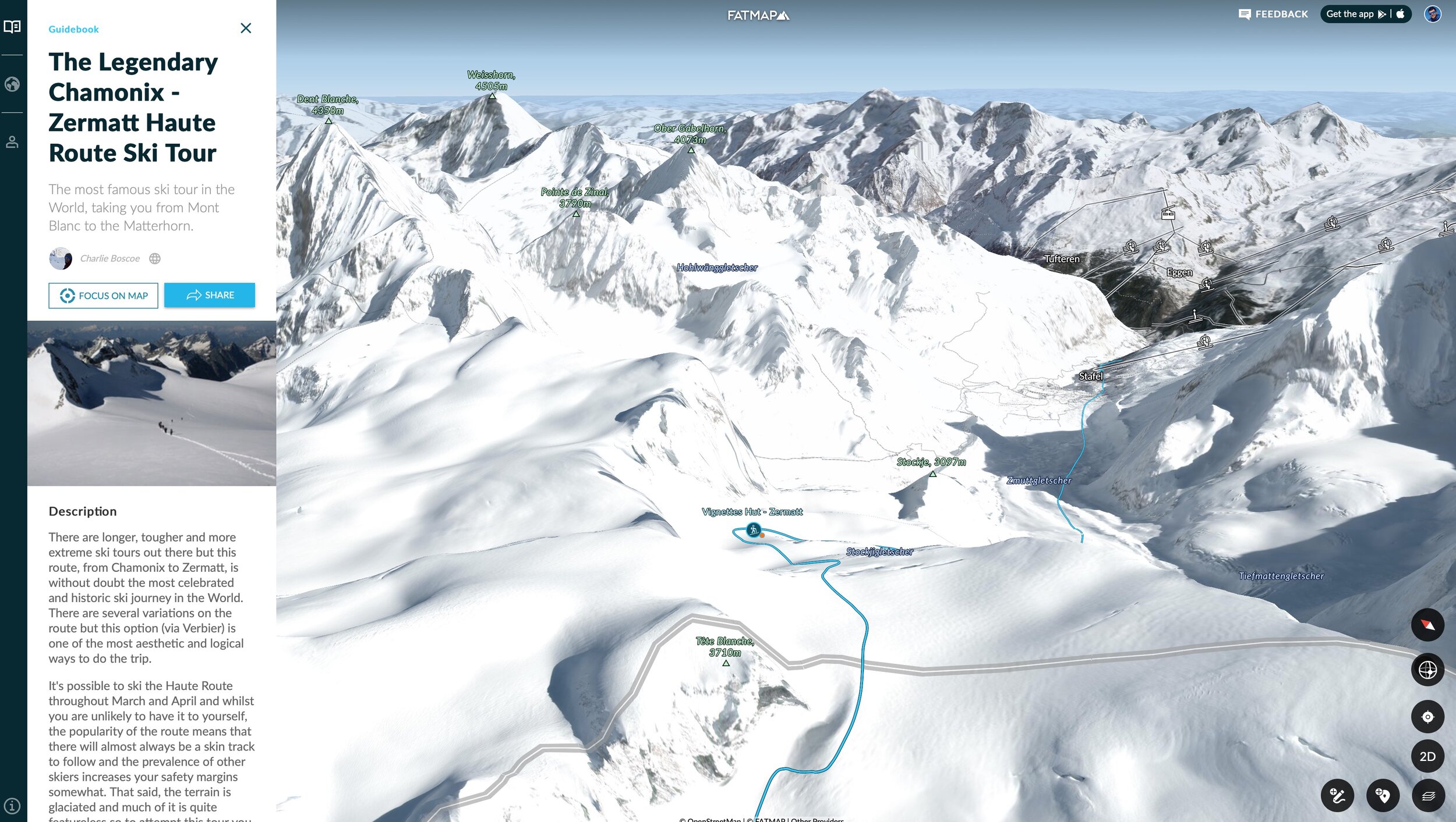
Some of the most popular Guidebooks on FATMAP are multi-day tours that show you the route for each day and what’s involved. Check out one of the most popular ones, the Haute Route ski tour Guidebook.
Tip: Did you know you can create your own Guidebooks? Here’s how.
“Today I use FATMAP in almost all my outdoor activities... to plan new projects or to see an activity afterwards, it is very easy with the routes and waypoints.”
Creating Your Adventures
When you’ve got your route in mind, the next step is to get it added to the map.
With our adventure creation feature you can draw it on the map yourself or, if you have the GPX file, upload it to the map directly.
You can also add details such as photos, title, description and a difficulty rating to your route. Check out our tutorial videos below for both options.
“I use FATMAP to browse my area for route options and trail ideas, look at all those beautiful trails to run!”
Understanding the terrain
With our wide array of terrain tools and live data, you have everything you need at your finger tips to understand the terrain for your adventures.
Travel Distance Layer
Trying to work out where you can get to in a set amount of time? Our Travel Distance Layer is the perfect tool for the job.
All you have to do is set the location and time, and the Travel Distance Layer will do the rest for you. This useful tool takes into account the type of activity and the geographical properties of the terrain such as how steep it is. The travel distance layer is currently available on the web for hiking.
Read our full blog post on the Travel Distance Layer

Topo Maps
Topo Maps are available on both the web and app platforms for Switzerland, France, Austria, Germany, the USA, UK and Spain. All Topo Maps are accessed in the terrain tools menu, allowing you to easily select your preferred country. If you have a route selected or are viewing activities on the map, they will still be visible on the topo map, allowing you navigate and assess the terrain.
Terrain Tools and Live Data
Understand more about the area you are going into and getting up-to-date information on the conditions will help you make more informed decisions about your route.
At FATMAP, we’ve addressed these critical requirements with our Terrain Tools and Live Data overlays.
Some of the key tools include: Gradient, Aspect, Elevation, Snow Layers, Resort Status and more.
From the hunt for deep powder to planning a trail run - it’s great to be able to know how steep your route will be, where the snow is, if the lifts are open, and how much you’ll be ascending or descending.
Find out more about using our terrain tools and snow layers

We hope you enjoy planning and reliving your adventures with FATMAP!
Share your plans with us in the comments below or on social media with #FATMAP.
