
The World’s Best 3D Topo Maps
On both the FATMAP app and website Explore members have access to 11 different Topographic Maps.
Along with a Global Topo Map, there are also country-specific topographical maps for Austria, Germany, France, Spain, New Zealand, Norway, Great Britain, Sweden, Switzerland, and the USA.
We’ve already had some amazing feedback since they launched and we’re happy to say we’ll be adding more on a regular basis!
Our aim with FATMAP is to provide you with all the tools you will need to plan and navigate safely on your adventures. While our satellite maps and terrain tools give you plenty of information to understand the terrain, topographical maps add that extra layer of detail.
“Since the release of Topo Maps, we’ve been using them in correlation with FATMAP’s custom angle overlays and exportable route planning more than the original high resolution photo imagery itself. It is incredibly powerful digital mapping!”
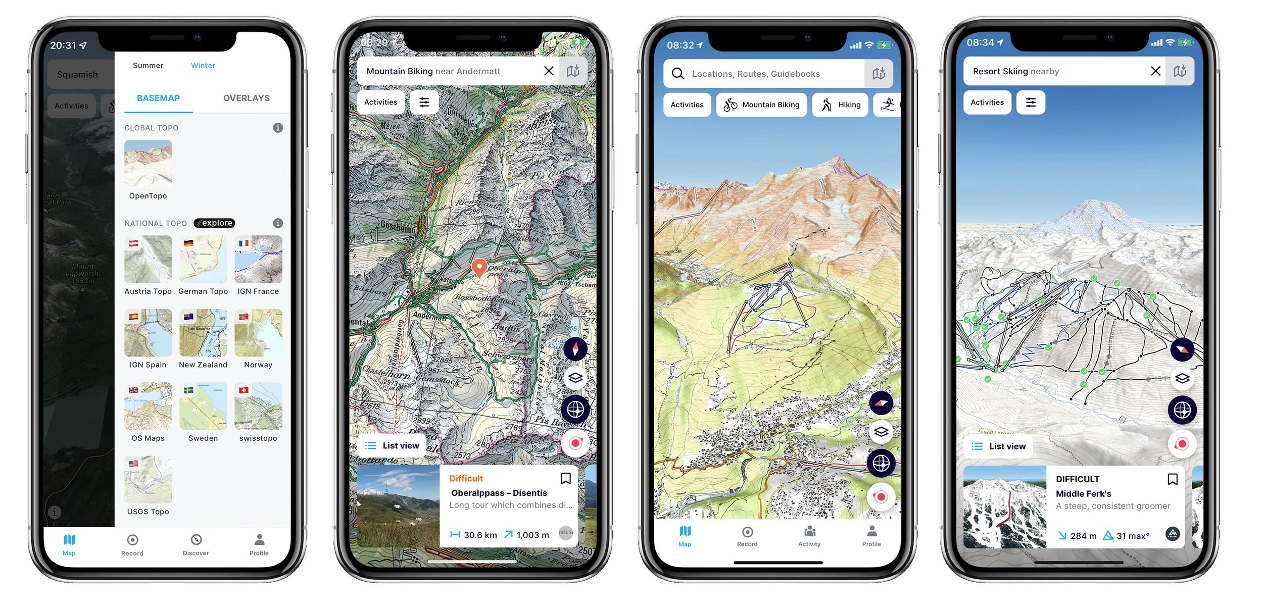
As you can see in the image above, all Topo Maps are accessed in the terrain tools menu, allowing you to easily select your preferred country. If you have a route selected or are viewing activities on the map, they will still be visible on the topo map, allowing you navigate and assess the terrain.
Topo Maps are currently available on both the FATMAP App and website with the Explore membership.
Not an Explore member? Try it for free for 7 days with our free trial!
Let us know what you think of the Topo Maps and which countries you’d like to see us add!
Team FATMAP