
Major Improvements to Offline Map Downloads & POIs!
We’re more than excited to announce some major updates and improvements to both offline map downloads and points-of-interest, so you'll be better prepared than ever for your mountain adventures!
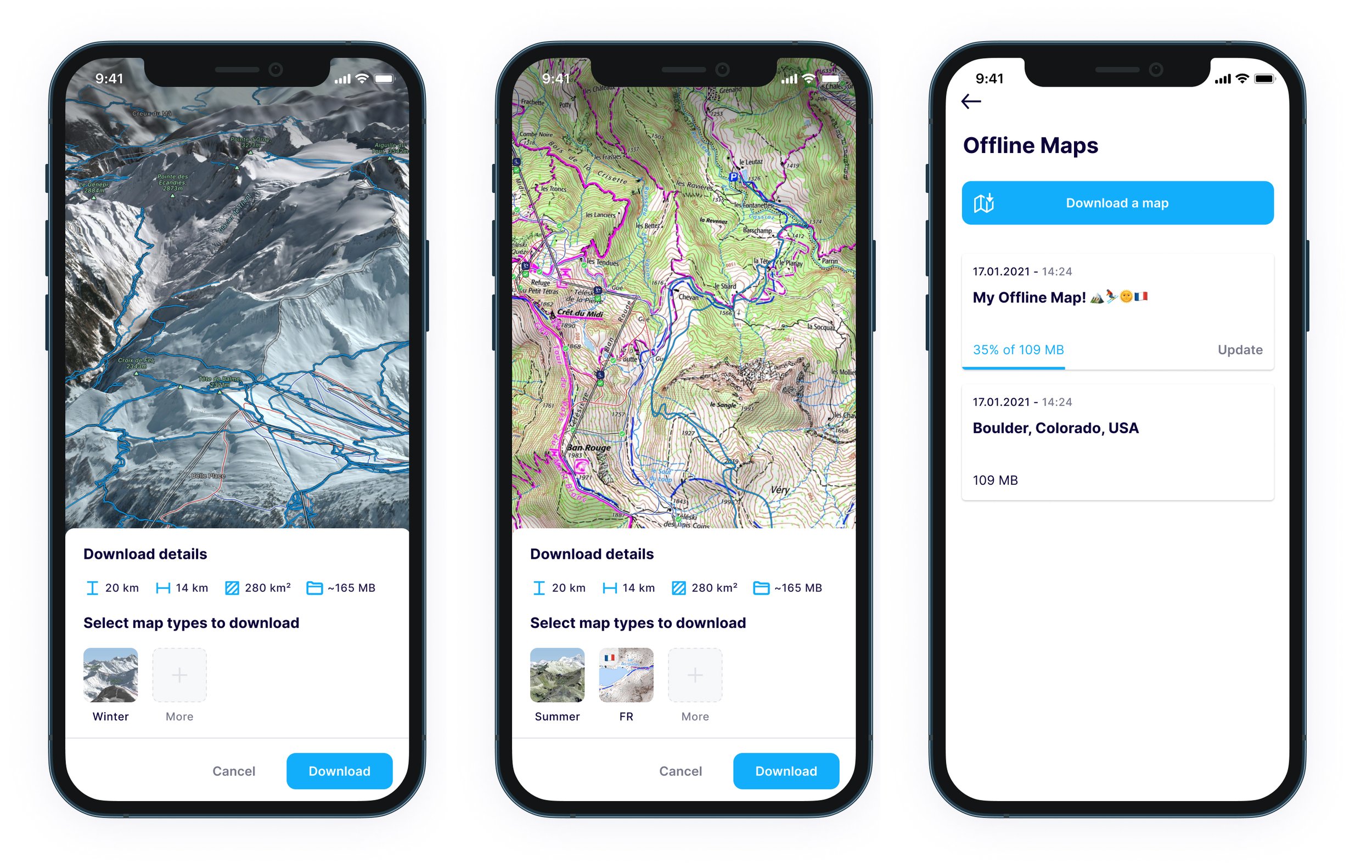
Faster Map Downloads & Offline Topographic Maps
Now you can make sure you're ready to head out into areas with poor mobile or cellular signal, as we've not only improved the speed of offline map downloads but you can now also download topographic maps as well as both summer and winter satellite imagery too!
That's right - it's been a highly requested feature by you, our community, and now Explore members can access our Global Topo & 10 different national topographic maps on the FATMAP mobile app in offline mode!
Make sure you have the latest update installed and then give it a whirl!
You can also check out our step-by-step guide here on exactly how to go about downloading offline maps.
New & Improved Outdoor Points-Of-Interest!
And that's not all!
FATMAP's latest update also offers you a greater level of detail so you know exactly what to expect on your next adventure with even more outdoor POIs, such as alpine huts, weather shelters and trailheads, as well as improvements to our existing ones, making them brighter and easier to find.

Some of the new POIs we've added include: Alpine Huts, Wilderness Huts, Basic Huts, Trailheads, Lean-to Shelters, Picnic Tables (individual tables, instead of just sites), Weather Shelters, Bike Shops...
... and many, many more!


Any particular POIs we've missed that you'd like to see? Let us know and we'll get them added!
Find out more about POIs in our FAQ article here.
Not an Explore member yet? You can try Explore for 7 days, completely free, and access unlimited offline map downloads, topographic maps, customer terrain layers and receive exclusive benefits with the world’s best outdoor brands and destinations.