
How an Avalanche Expert Plans His Adventures

Interview with Mike Austin
Whoever you are, planning for a day in the mountains is often the same for us all.
The more advanced trips may increase the level of detail you need but ultimately it’s about applying your knowledge of the weather, conditions, your risk tolerance and objectives to a map to find the right adventure for the day.
Avalanche educators spend their lives teaching people about how to understand the relationship between these factors to have a great day out in the mountains.
We catch up with Mike Austin, co-founder of AvalancheGeeks and one of its lead educators, to understand how he plans his routes and the most important things to get right.
Planning your adventures
FATMAP: How do you start planning for a day in the mountains?
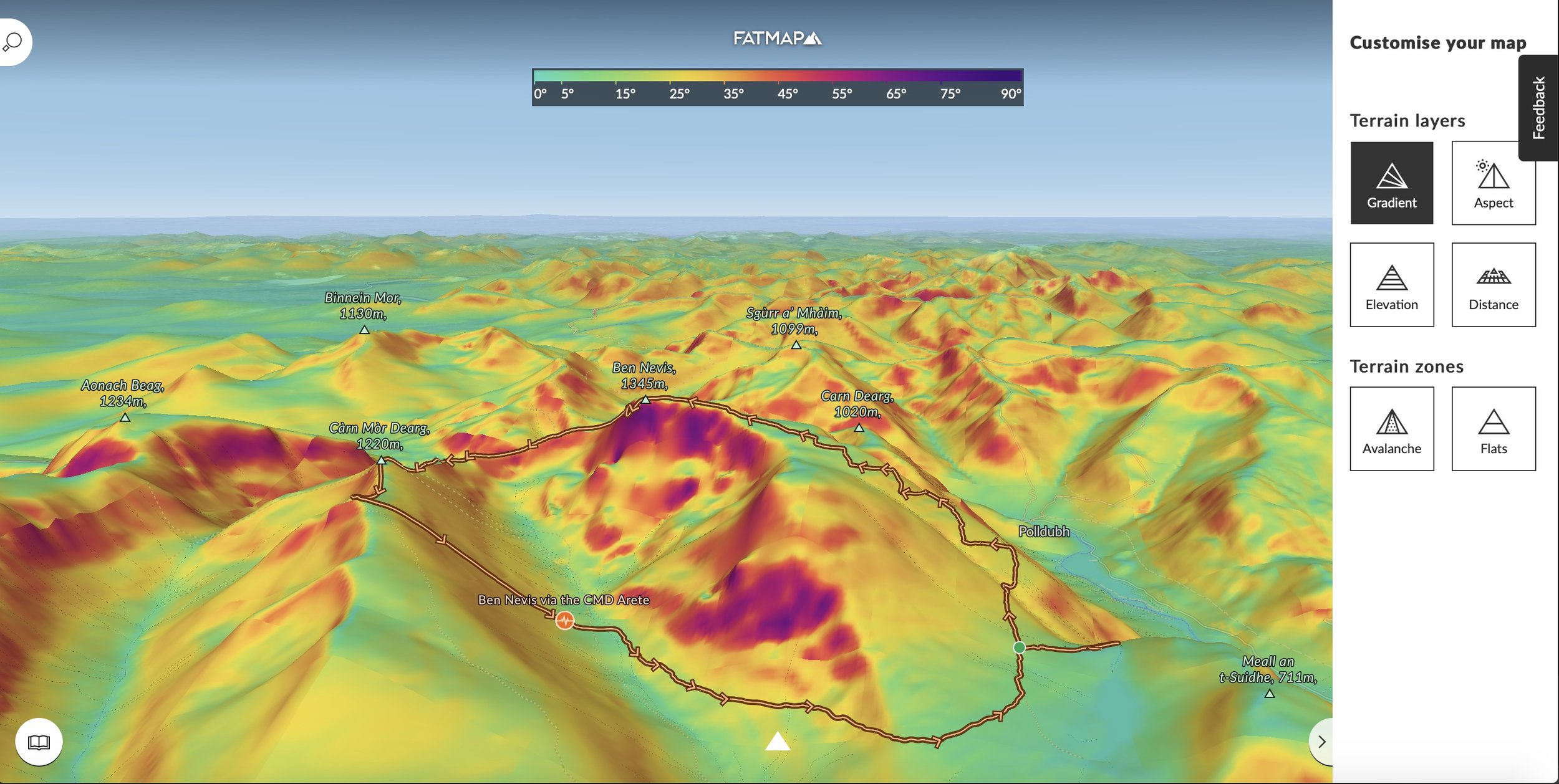
MA: After I’ve gathered the information about the day’s weather and avalanche forecast, I’ll start by using the draw function to plot my route on FATMAP. It gives us an instant height profile and distance of a proposed route. This draw function works really smoothly and unlike the draw function on other mapping software platforms it’s simple to delete and edit sections of the route as you’re drawing. This can then be saved as an adventure to share with friends and transfers seamlessly on to your mobile device with the FATMAP app.
A key advantage of the desktop software is that it allows for slow time planning, where you can examine your intended route in detail on a large screen. As creating a route is so quick, it’s easy to put in a couple of different route variations, which adds to the margin of safety. My main route will be my ideal objective given the conditions and people I’m skiing with. My plan B route will always be a shorter easier option - like a get out of jail option. If you have only planned one route, chances are you’ll just push ahead with that option, even when common sense dictates its no longer sensible.
On a recent trip to the remote Cuillin mountains on the island of Skye we timed our visit during the biggest drought in a decade. The streams where we’d planned to refill our water bottles were completely dry and after two days on our route we had to bail. Fortunately, we’d already prepared an escape option a few days earlier, descending a complex system of wide grassy ramps above cliffs. With FATMAP we had the confidence that we’d eventually reach the valley floor. Even large-scale maps can’t provide this level of detail.
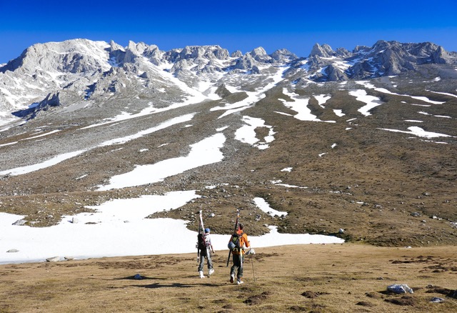
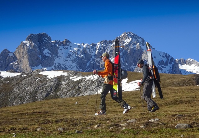
The island of Skye and the Cuillin mountains
Staying safe in the mountains
FATMAP: How does it compare to more traditional tools?
MA: Some people get really hung up about using digital mapping in the mountains. But it’s just another map. Another string to your bow. Paper maps certainly require time to gain the correct expertise, but when was the last time you used a street atlas on a car journey? FATMAP is doing to the mountains what your car GPS did to the paper city street atlas. This is a seriously powerful navigational tool. At AvalancheGeeks we’ve become strong advocates of using a GPS as your primary navigational device in the winter mountains. There are several reasons for this. Navigating with a map and compass on skis is extremely tough in comparison to using a map and compass on foot. When we’re on skis or a snowboard the mechanism of travel is very different, as we follow slopes of certain angles both in ascent and descent, often zig-zagging and contouring around terrain, and often covering distance at a variety of different speeds.
If we’re letting GPS take the navigational strain out on the mountain then we have plenty of bandwidth left to pay attention to other things; such as observing signs of recent avalanche activity, or unstable snow, discussing the most suitable ski lines with the group and picking up on potential issues that always affect our day in the mountains. We can think about the weather and how long we’re taking to tackle the objective, and where the best snow to ride on the mountain is hiding. All of these important considerations have to take a back seat if we’re trying to follow a compass bearing in complex navigational terrain. GPS navigation gives us an added margin of safety, and staying safe in the mountains is all about the margins we afford ourselves.

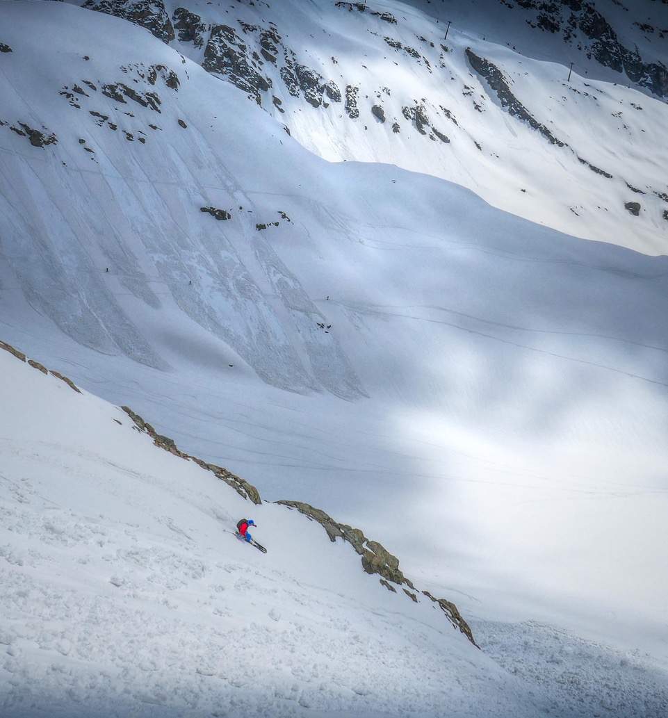
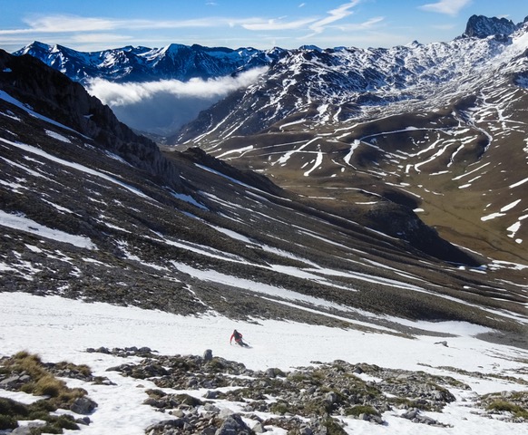
Sarah Thompson dropping into the great white unknown of the Italian side country. Prior planning on the desk top the previous night utilizing the avalanche angle overlay gave her the confidence to hit her line without visibility, strong in the knowledge that her slope would never get steep enough to avalanche…game on! Explore the location here
A better understanding of your terrain
FATMAP: Can you walk us through how you get important terrain information?
MA: The distance grid overlay and the avalanche terrain overlay are particularly useful in the planning stage at home on the desktop version of the software. We can literally thread a needle through avalanche terrain should snowpack stability be a concern. Remember though, it’s always important to be aware of avalanche slopes above us that we are connected to as well as the slopes that we are actually on. FATMAP’s 3D imagery helps massively visualize this fact.
In the winter mountains the aspect overlay is a key planning tool. It’s really important for us to have a handle on northerly aspect in the first half of the season. This is where the coldest, driest snow lays. Great for skiing, but science tells us that these north and north easterly aspects are where dangerous layers within the snowpack most often form in the snowpack early in the winter. Using the aspect overlay helps us visualize when we’re going to be on these keys slopes during the day, and the option to avoid them completely at this planning stage should the avalanche hazard forecast warn us about these slopes.
“Used in conjunction with paper mapping, FATMAP is an extremely powerful tool to aid your mountain adventures. Both in the planning stage at home on a desktop and in the mountains on its mobile platform.”
Spending time on the desktop version of FATMAP prior to a journey allows the terrain to be examined in hi-resolution detail. This is especially valuable for key points of your journey…such as dropping into your line.
Navigating with confidence
FATMAP: And what about your workflow?
MA: Dropping waypoints onto the FATMAP app at key points of our intended route is super easy. Press the screen and hold where you want the waypoint and the pin drops right there. Tap on it and you can edit its name. Currently these are locations on a landscape to give yourself a reference and your GPS location, but their functionality will increase with software updates and you’ll soon be able to navigate to them. You can also export gpx files that you’ve created on FATMAP onto other GPS devices.
For me this has been a key update. I can now use the desktop version of FATMAP as my database of all my routes and send them to my GPS device as I wish. I really like the mobile version of FATMAP, but I’m always worried about phone battery life in the winter mountains. Using a third party GPS such as a Garmin means I have spare batteries to swap out and these units are ruggedised for the mountains, so now I get the best of both worlds.
Read our blog on how to export your GPX files
With downloadable sections of terrain that can be used offline, FATMAP aims to provide state of the art mapping that also has the functionality of a hand-held GPS device.
The ability FATMAP gives us to locate ourselves accurately on a map whilst in the field is extremely powerful. Once we knew exactly where we are we can project bearing and distances onto our paper map with confidence, and refer back to the FATMAP app to confirm that we’re heading in the right direction and error correct as we go along. Used in conjunction with paper mapping, FATMAP is an extremely powerful tool to aid your mountain adventures. Both in the planning stage at home on a desktop and in the mountains on its mobile platform.

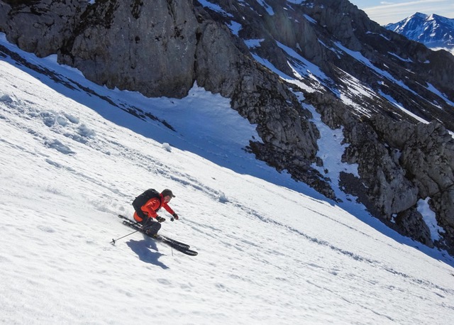
In low visibility, having a plan and a route to follow is crucial
FATMAP: Do you have any tips for people who want to start using digital tools to plan?
MA:
Use the desktop version as your initial go to planning tool – view the landscape in conjunction with the paper map you’ll carry on the hill. Mark key points of your route onto the paper map with a pen.
Download the area in which you intend to travel onto the mobile FATMAP app on your phone. This way you’ll have the area saved offline and won’t need a data signal to navigate. It’s unlikely that there will be a mobile data signal if you are heading into the wilderness!
Power up! GPS and 3D data rendering sucks phone batteries dry. Start you day fully charged up. Shut down non-essential phone functions. The easiest way to do that is to put your phone into airplane mode. Consider taking a portable battery charger on multi-day trips.
Keep your phone in a protective case for better insulation and store it in your inside chest pocket. This not only keeps it handy for on-the-fly location checking, but also keeps it warm. Mobile phones hate the extreme cold in the winter and your backpack pocket won’t be warm enough.
Your phone should never be your sole navigational tool – as with all essential tools there should be redundancy in your navigational system.
AvalancheGeeks are the avalanche safety partner of FATMAP, an avalanche education company that provides courses and training for the public and mountain professionals in the European Alps & Scotland.
They are supported by Dynastar and you can follow them: INSTAGRAM FACEBOOK TWITTER